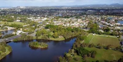
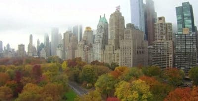
Terrific Benefits Of Drones In Rescue, Wildlife, Farming And Business

Best uses of drones providing solutions across many sectors

There are many terrific benefits of drones across multiple sectors.  Every week, we read about the new benefits of using UAVs for inspections.

Drones being used in sectors, such as science, agriculture, construction, marketing, archaeology, conservation, the environment. Drones are benefiting search and rescue missions immensely.

They are saving lives, time and money. A couple of years ago, you would only see drone scenery videos on the Internet with very few news items about drones in other sectors. Not any more.

Drone innovation and technology have improved immensely. Combining improved drone technology with existing technology (cameras, infrared, sensors, 3D mapping and software) has given Researchers, Scientists, Universities and Business new avenues for their use.

The drive to seek better solutions to problems is perhaps the main reason why drones are becoming so popular.

Read more

Neutral Density Filters For Great Aerial Landscape Photography

Fantastic Aerial Landscape Photo Using A Neutral Density Gradient Filter

A quality neutral density gradient filter is one of great tools used by top aerial photographers to capture the perfect photo and film.

Here, we’ll explain what a neutral density gradient filter does and how it will add that extra bit of quality to your aerial landscape photography.

Along with this information on graduated neutral density filters, there is a couple of videos at the end on this subject.

Read more

What Are Drones Used For From Business To Critical Missions

What are drones used for answered with full list

What are drones used for answered here covering every sector you can think of.  Drones are being used to save lives, environment works, archaeology, farming, property management, mining, construction and much more.

We start by looking at what drones are used for in specific sectors and include some terrific videos along the way.

The drone industry is growing fast and every week we see press releases and research papers on what new areas drones are being used for.

The usage of drones in some of these sectors was originally completed using helicopters and airplanes. However, these are expensive to hire and not always available when they were required.

Using helicopters and airplanes is also very time consuming as they have to fly in from other locations and then do their work.

Along with present uses for drones, we also look at new drone uses, which are still in the experimental and research stages.  Without doubt, you will see hundreds of new uses for drones in the coming years.  There are also some terrific videos throughout this post.

Read more

Introduction To UAV Photogrammetry And Lidar Mapping Basics

Using UAVs for photogrammetry and aerial LiDar mapping

UAV lidar and photogrammetry imaging applications are increasing rapidly. This is not surprising as using GPS enabled UAVs for aerial surveying is very cost effective in comparison to hiring an aircraft with photogrammetry equipment.  

Because UAVs are relatively inexpensive, organisations will have their own UAV fleet, allowing for rapid surveys over large land areas and infrastructure projects where required. 

With GPS equipped drones, digital cameras and powerful computers, surveys have an accuracy right down to 1 centimeter.

This post takes an overall look at this drone mapping technology. We also take a quick view at the sectors benefiting from using UAVs for photogrammetry and lidar mapping.  We also look at some of the best mapping drones on the market along with the compatible software.

Another closely related sector is using LiDAR sensors mounted onto drones.  It’s another growing sector and you can read further regarding drone LiDAR use here. 

Read more