12 Top Drones With Cameras, GPS, Autopilot And Low Prices

Walkera Scout X4 With Drone GPS Autopilot and 4k Camera

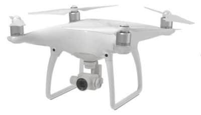
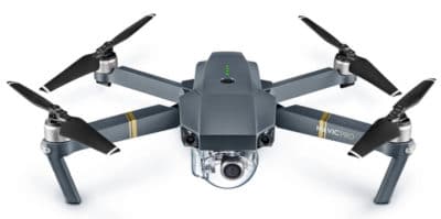
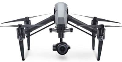
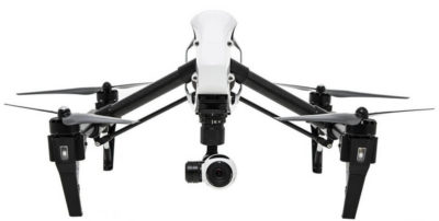
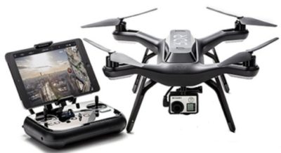
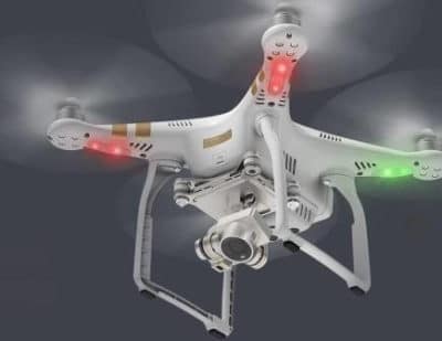
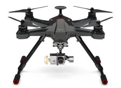
The top drones with 4k cameras reviewed here also have excellent GPS and autopilot systems, giving you many options, when it comes to flying, aerial filming and photography.

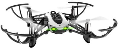
Along with great cameras, GPS and autopilot, these drones with low prices have many safety features.

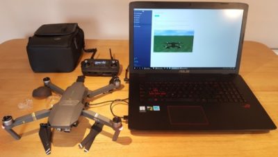
These top drones featured below all have 4k cameras and can be flown by pilot manually or on autopilot. A drone flying on autopilot has big advantages over manual flight.  With an autopilot programmed route, called waypoints, the drone can take aerial photos or video much better than any pilot can.

This is especially true in difficult weather conditions.  A drone flying in autopilot mode is monitoring and adjusting its position thousands of times per second.  Manual flying will never be able to achieve this flight accuracy.

For aerial photography, it is great to let the drone fly on autopilot on a given route, while you concentrate on working the camera capturing the best of video and stills.

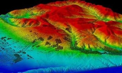
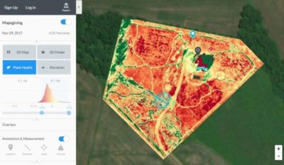
Having a drone with a GPS autopilot flight system and a 4k camera is very  essential for aerial photogrammetry, 3D mapping and multispectral imaging in the agricultural sector.

Read more

Top DJI Phantom 4 Pro Intelligent Flight Modes Reviewed

DJI Phantom 4 Intelligent Flight Modes

The Phantom 4 Pro intelligent flight modes make flying and producing meaningful aerial imagery so much easier.  Here, we review the Phantom 4 Pro including the new Phantom 4 Pro v2.0 intelligent flight modes, specifications and features.

The Phantom 4 Pro autonomous flight modes, along with new stabilization system and professional 4k camera make this drone an exceptional investment.

For aerial cinematography, the Phantom 4 flight modes allow you the capture film from various different flying angles.

The Phantom 4 Pro is an excellent quadcopter for professional site surveying, 3D imaging of terrain and photogrammetry of structures.

You can read further on these uses in this the article “Introduction To UAV Photogrammetry and Lidar Mapping“.

The Phantom 4 Pro also has many autonomous safety systems such as obstacle detection and smart return to home technology.

Read more

DJI Assistant 2 Mavic Software, Download, Guide, Mods And More

DJI Assistant 2 Mavic

The DJI Assistant 2 software contains extra settings and utilities for all DJI equipment such as drones, gimbals and cameras.

With the DJI Assistant 2 Mavic, you have options to upload  flight data, black box information, calibrate your vision sensors and upgrade your firmware.

There is also a DJI Assistant 2 Simulator for testing flight parameters and practice flying your Mavic drone.

The DJI Assistant 2 download and install only takes a few minutes and is available for Windows and Mac computers.

This post contains all the essential information and more on the DJI Assistant 2 app for the Mavic quadcopter. Now, if you have a Phantom 4 or DJI Spark, the DJI Assistant 2 is the same version. Therefore the below Assistant 2 settings and utilities will be very similar.

Read more

Introduction To UAV Photogrammetry And Lidar Mapping Basics

Using UAVs for photogrammetry and aerial LiDar mapping

UAV lidar and photogrammetry imaging applications are increasing rapidly. This is not surprising as using GPS enabled UAVs for aerial surveying is very cost effective in comparison to hiring an aircraft with photogrammetry equipment.  

Because UAVs are relatively inexpensive, organisations will have their own UAV fleet, allowing for rapid surveys over large land areas and infrastructure projects where required. 

With GPS equipped drones, digital cameras and powerful computers, surveys have an accuracy right down to 1 centimeter.

This post takes an overall look at this drone mapping technology. We also take a quick view at the sectors benefiting from using UAVs for photogrammetry and lidar mapping.  We also look at some of the best mapping drones on the market along with the compatible software.

Another closely related sector is using LiDAR sensors mounted onto drones.  It’s another growing sector and you can read further regarding drone LiDAR use here. 

Read more

DJI Inspire 1 Drone Review Including Zenmuse Camera Options

DJI Inspire 1 Design, Gimbal and Camera Review

This updated DJI Inspire 1 drone review takes a close look at the features, design, gimbal and camera options on both the Inspire Standard and Professional models.

The Inspire 1 has entered new territory in drone innovation, sleek design and patented motor and gimbal engineering.  The Inspire 1 drone is very versatile with various cameras and sensors options.

In this Inspire 1 review, we take a full look at its design, intelligent flight modes, gimbals and many camera options, along with a number of top Inspire 1 videos.  We answer the many frequently asked questions such as the Inspire 1 range, distance, max height, altitude, frequency, sensors, transmission, WiFi, gimbal, camera and much more.

The DJI Inspire 1 is very close to the perfect quadcopter. The Inspire 1 allows anyone to create great aerial photography and filming shots. There are a number of cameras which can be fitted to the Inspire 1.

The latest camera is the Zenmuse Z3 which is the first integrated aerial zoom camera optimized for still photography. Being able to detach the gimbal on the Inspire 1 allows this drone to be used for more than just aerial filming.

For example, the Inspire 1 Pro comes with the Zenmuse X5 gimbal and 4k micro four thirds camera. This Zenmuse X5 gimbal can be removed and the new Zenmuse XT thermal imaging sensor can be attached giving the Inspire 1 real flexibility to provide solutions in many different sectors.

Fire Departments use drones to get an overall view of the area where they are battling a blaze whether it is a building or a forest.   They are also using thermal vision cameras to get information on the heat of a fire or the heat from a fire which has just been put out.

Or, how about attaching the latest Parrot Sequoia multispectral sensor for farming allowing the Inspire 1 to capture both visible and invisible images of crops, vegetation and ground cover.

The Inspire 1 is designed with adaptability in mind.

Read more

How To Update 3DR Solo Firmware To Fix Issues And Add Features

How To Update 3DR Solo Firmware

Knowing how to update your 3DR Solo firmware to the latest version is very important.  The Solo firmware upgrades will fix bugs in the software along with adding new flight features giving you a far better flying and filming experience.

Upgrading the firmware software on the Solo remote controller and quadcopter is pretty easy.

The whole process takes approximately 15 mins overall.  We will take you through the steps here with an excellent video at the end.

3DR really pack their firmware upgrades with plenty of new features for the Solo quadcopter, the GoPro camera and the remote controller.  They have added new flight control systems,  introduced extra features to the Solo App and expanded their SDK software.

Read more

DJI Phantom 3 Drone Reviewed And Very Low Prices

DJI Phantom 3 Review of both the Professional And Advanced Model

In this Phantom 3 review we look at its innovative technology and features which make this drone the most popular on the market. In the past couple of weeks the DJI Phantom 3 has become even better value with lower prices.  Further down this post, I have links to where you can get the best prices for the Phantom 3 Professional, Advanced and Standard models.

Even though, there are newer drones from DJI on the market, the  Phantom 3 nevertheless has everything you would want in a drone.  Many of the top aerial landscape filming on YouTube have been filmed with the Phantom 3.

The Phantom 3 is very powerful, highly responsive and will fly precisely to your commands.  The integrated gimbal and camera greatly assist you to take professional aerial photos and film. Without doubt, the Phantom 3 is very impressive to fly and film with.

This Phantom 3 review with videos takes a close look at the flying and filming capabilities along with its features and improvements.  The Phantom 3 flies longer; has a 4k UHD camera; a new Vision Positioning system; stronger GPS signalling and reliability; a totally revamped remote controller; massive improvement in precision flying with much improved responsiveness and performance from both the quadcopter and camera.

Latest Drones

This post is quite old and while you can still find some Phantom 3 quadcopters available, the latest drones at low prices are pretty outstanding in comparison to the technology in the Phantom 3. You can also visit the DJI home page for their latest DJI consumer drones.

Read more

Top DJI Matrice 100 Review For Creating New Solutions

Top DJI Matrice 100 Review

The Matrice 100  drone can be programmed using the DJI Special Development and Guidance Visual Sensing System. This Matrice 100 review looks at the technology, specifications and features of this modular and adaptable programmable sensor drone.

This Matrice drone is designed with the developer in mind. It will  allow developers from all sectors to use the Matrice 100 as a platform to create new hardware and software applications and solve real life problems.

The Matrice 100 is a dual system.  You have the quadcopter and also the guidance visual sensing system as an add on.  It’s ready to fly straight out of the box.  The real benefit is in using the interface between the Matrice 100 and the DJI SDK to create new aerial solutions.

This quadcopter has sensors, a collision avoidance system and has tremendous options to customize. Because the Matrice 100 is highly advanced  and very customizable, it gives developers and engineers flexibility to be creative.   You customize and create solutions using the Matrice 100, the Guidance Vision Sensing System and the DJI Special Development Kit.

Read more

Top 3DR X8 Quadcopter For Mapping And Aerial Filming

3DR Robotics X8-M Quadcopter For 3D Mapping

The 3DR X8 quadcopter range is without doubt top notch. In this X8 quadcopter review, we look at this powerful, reliable and easy to fly drone along with its options and uses.  We review both the X8+ for aerial photography, the X8-M for mapping and the Mission Planner software.

What the X8 quadcopter gives you in abundance, is options in its use. It is an autonomous drone which can take off, fly the path you have programmed in and land again.  3DR who are at the forefront in drone innovation have created a very robust platform for both aerial filming with the X8+ or creating sophisticated 3D maps and models with the X8-M quadcopter.

Read more