Multispectral Remote Sensing Drones For Golf Course Vitality

Multispectral Remote Sensing Drones For Golf Courses

Data from multispectral remote sensing drones provide essential feedback on the health of a golf course. Multispectral sensor data can detect problems from pests, disease, invasive weeds and stress to greens, fairways, rough, shrubs and trees long before the naked eye will notice.

This article explains why multispectral drones often called Remote Sensing Platforms are fast becoming a very essential tool every golf course should invest in.

Read more

12 Top Lidar Sensors For UAVs, Best Lidar Drones And Great Uses

7 Top Lidar Sensors For Drones

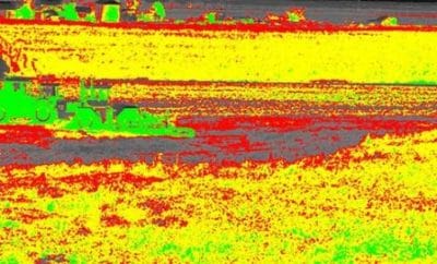
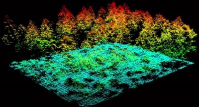
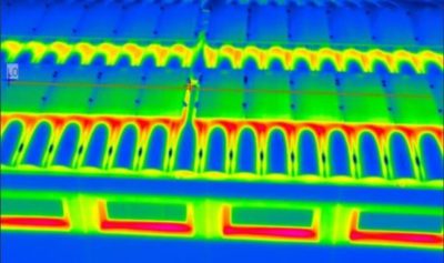
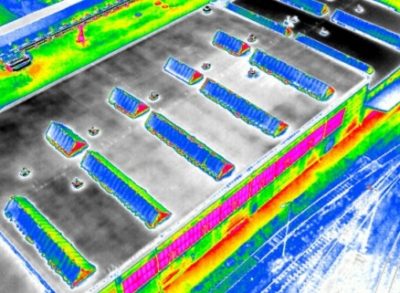
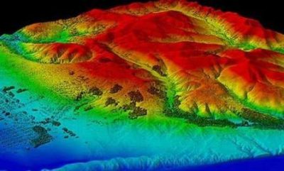
Lidar sensors on UAVs capture imagery which only a few years ago needed an aircraft carrying large heavy lidar sensors and a crew to accomplish.

Here, we look at 12 of the best lidar sensors for drones along with the best lidar drones.

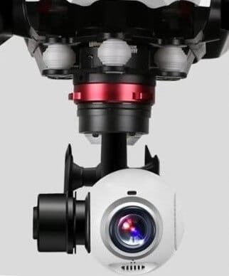
We feature lidar sensors from manufacturers such as Velodyne, Routescene, Leddartech, Riegl, YellowScan, Leica and Geodetics.

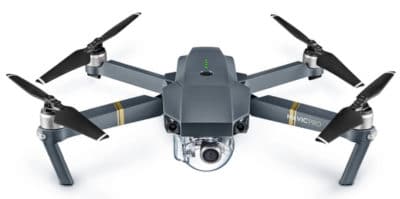
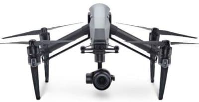
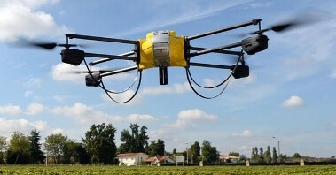
The lidar drones include quadcopters, fixed wing drones, UAV helicopters from manufacturers such as DJI, Harris, Velos, Vulcan, OnyxStar and many more.

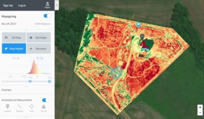
A lidar sensor mounted on a UAV, along with the lidar software can process images very quickly in the cloud, allowing for effective decisions to be made by stakeholders and relevant parties.

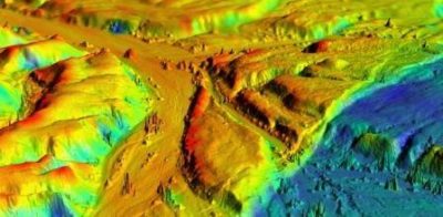
The output from these lidar drones and sensors is outstanding.  The pace of development and improvement in the lidar sensors over the past few years has been tremendous and will continue with more entrants into this sector.

Over the coming years, we are going to see most of the lidar sensor work moving from aircraft to lidar drones.

In fact, all the manufacturers of the large lidar sensors for airplanes have developed smaller lidar sensors for drones.

We start off this post with the lidar drones being used for the various sensors, followed by how lidar sensor technology works. Then, we look at the best lidar sensors for drones.  Along the way, we have some terrific lidar drone sensor videos.

Read more

Multispectral Imaging Camera Drones In Farming Yield Big Benefits

Multispectral imaging agriculture drones with sensors

Multispectral imaging camera sensors on agricultural drones allow the farmer to manage crops, soil, fertilizing and irrigation more effectively.

There are huge benefits both to the farmer and to the wider environment by minimizing the use of sprays, fertilizers, wastage of water and at the same time increasing the yield from crops.

Multispectral camera remote sensing imaging technology use Green, Red, Red-Edge and Near Infrared wavebands to capture both visible and invisible images of crops and vegetation.

The multispectral images integrate with specialized agriculture software which output the information into meaningful data.

This land telemetry, soil and crop data allow the  grower to monitor, plan and manage the farm more effectively saving time and money along with reducing the use of pesticides. 

Read more

Calibrate Mavic Pro Vision Sensor And Fixing System Error

Calibrate Mavic Pro Vison Sensor To Fix System Error

Knowing how to calibrate the Mavic Pro vision sensor is very important.  If the vision system error on your Mavic Pro appears, then calibration may fix the problem.

Also, if you are flying your Mavic Pro and the vision system error occurs, you need to fly the quadcopter back to you straight away.

Below we have instructions on the Mavic Pro vision sensor calibration process, along with notes and videos. There is also terrific information on the Mavic Pro Vision Positioning system.

Very importantly, there are some top tips on how to resolve the vision system error on the Mavic.

The Mavic Pro uses the GPS, Forward and Downward vision sensors to locate itself, automatically stabilize and navigate between obstacles.  The vision sensors feed essential data back to the flight controller which then responds by issuing automatic commands to avoid or hover in front of the obstacle.

If the Mavic Vision Positioning System isn’t working correctly or not at all, then there is a real possibility that the Mavic will crash.

Read more

Terrific Benefits Of Drones In Rescue, Wildlife, Farming And Business

Best uses of drones providing solutions across many sectors

There are many terrific benefits of drones across multiple sectors.  Every week, we read about the new benefits of using UAVs for inspections.

Drones being used in sectors, such as science, agriculture, construction, marketing, archaeology, conservation, the environment. Drones are benefiting search and rescue missions immensely.

They are saving lives, time and money. A couple of years ago, you would only see drone scenery videos on the Internet with very few news items about drones in other sectors. Not any more.

Drone innovation and technology have improved immensely. Combining improved drone technology with existing technology (cameras, infrared, sensors, 3D mapping and software) has given Researchers, Scientists, Universities and Business new avenues for their use.

The drive to seek better solutions to problems is perhaps the main reason why drones are becoming so popular.

Read more

What Are Drones Used For From Business To Critical Missions

What are drones used for answered with full list

What are drones used for answered here covering every sector you can think of.  Drones are being used to save lives, environment works, archaeology, farming, property management, mining, construction and much more.

We start by looking at what drones are used for in specific sectors and include some terrific videos along the way.

The drone industry is growing fast and every week we see press releases and research papers on what new areas drones are being used for.

The usage of drones in some of these sectors was originally completed using helicopters and airplanes. However, these are expensive to hire and not always available when they were required.

Using helicopters and airplanes is also very time consuming as they have to fly in from other locations and then do their work.

Along with present uses for drones, we also look at new drone uses, which are still in the experimental and research stages.  Without doubt, you will see hundreds of new uses for drones in the coming years.  There are also some terrific videos throughout this post.

Read more

Introduction To UAV Photogrammetry And Lidar Mapping Basics

Using UAVs for photogrammetry and aerial LiDar mapping

UAV lidar and photogrammetry imaging applications are increasing rapidly. This is not surprising as using GPS enabled UAVs for aerial surveying is very cost effective in comparison to hiring an aircraft with photogrammetry equipment.  

Because UAVs are relatively inexpensive, organisations will have their own UAV fleet, allowing for rapid surveys over large land areas and infrastructure projects where required. 

With GPS equipped drones, digital cameras and powerful computers, surveys have an accuracy right down to 1 centimeter.

This post takes an overall look at this drone mapping technology. We also take a quick view at the sectors benefiting from using UAVs for photogrammetry and lidar mapping.  We also look at some of the best mapping drones on the market along with the compatible software.

Another closely related sector is using LiDAR sensors mounted onto drones.  It’s another growing sector and you can read further regarding drone LiDAR use here. 

Read more

UAVs In The Lidar Applications Sector Increases Substantially

Lidar Applications And Systems Using UAVs

The market for lidar UAVs and their applications is growing fast and and will continue to increase over the next decade.  In 2015, the figure spent on drones using Lidar was around the USD 300 million.

However the lidar market is expected to rise to more than $1 billion by 2020. This is an increase of 20% year on year to 2020.

Many still view airborne lidar applications through the use of fixed wing pilot aircraft.  The high cost or renting lidar equipped aircraft, pilots, lidar trained engineers has kept the use of this extremely useful technology pretty much to the minimum.  Only big money and big budgets could afford to use airborne lidar systems regularly.

Read more