Calibrate Mavic Pro Vision Sensor And Fixing System Error

Calibrate Mavic Pro Vison Sensor To Fix System Error

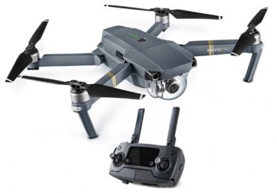
Knowing how to calibrate the Mavic Pro vision sensor is very important.  If the vision system error on your Mavic Pro appears, then calibration may fix the problem.

Also, if you are flying your Mavic Pro and the vision system error occurs, you need to fly the quadcopter back to you straight away.

Below we have instructions on the Mavic Pro vision sensor calibration process, along with notes and videos. There is also terrific information on the Mavic Pro Vision Positioning system.

Very importantly, there are some top tips on how to resolve the vision system error on the Mavic.

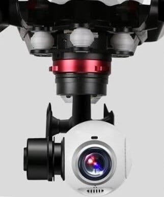
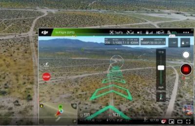
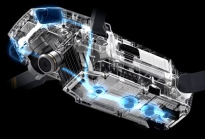
The Mavic Pro uses the GPS, Forward and Downward vision sensors to locate itself, automatically stabilize and navigate between obstacles.  The vision sensors feed essential data back to the flight controller which then responds by issuing automatic commands to avoid or hover in front of the obstacle.

If the Mavic Vision Positioning System isn’t working correctly or not at all, then there is a real possibility that the Mavic will crash.

Read more

Neutral Density Filters For Great Aerial Landscape Photography

Fantastic Aerial Landscape Photo Using A Neutral Density Gradient Filter

A quality neutral density gradient filter is one of great tools used by top aerial photographers to capture the perfect photo and film.

Here, we’ll explain what a neutral density gradient filter does and how it will add that extra bit of quality to your aerial landscape photography.

Along with this information on graduated neutral density filters, there is a couple of videos at the end on this subject.

Read more

Introduction To UAV Photogrammetry And Lidar Mapping Basics

Using UAVs for photogrammetry and aerial LiDar mapping

UAV lidar and photogrammetry imaging applications are increasing rapidly. This is not surprising as using GPS enabled UAVs for aerial surveying is very cost effective in comparison to hiring an aircraft with photogrammetry equipment.  

Because UAVs are relatively inexpensive, organisations will have their own UAV fleet, allowing for rapid surveys over large land areas and infrastructure projects where required. 

With GPS equipped drones, digital cameras and powerful computers, surveys have an accuracy right down to 1 centimeter.

This post takes an overall look at this drone mapping technology. We also take a quick view at the sectors benefiting from using UAVs for photogrammetry and lidar mapping.  We also look at some of the best mapping drones on the market along with the compatible software.

Another closely related sector is using LiDAR sensors mounted onto drones.  It’s another growing sector and you can read further regarding drone LiDAR use here. 

Read more