12 Best Follow Me Drones And Follow You Technology Reviewed

Follow Me GPS Drone Technology and Best Follow ME UAVsw

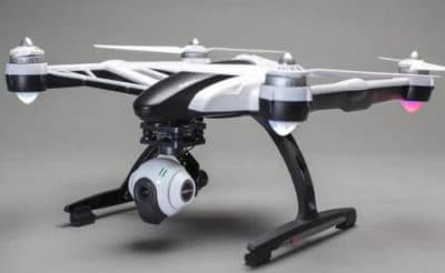
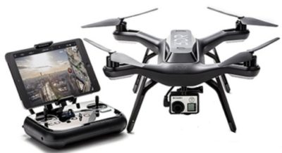
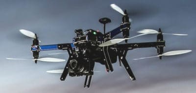
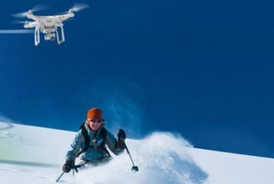
With Follow Me drone technology, the UAV is programmed to automatically follow you around, giving you plenty of opportunities to film unique aerial shots.

At present there are 2 types of drone Follow Me technology.  Here, we look at the technology used in drones that follow you.

Then, we review the 12 best follow me drones on the market right now, with some terrific videos along the way.

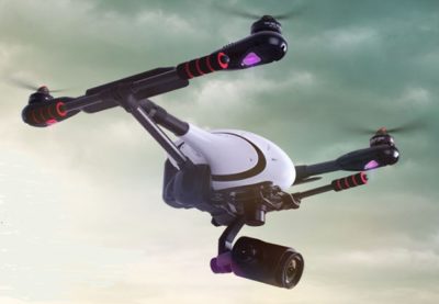
We review drones which follow you from DJI, Walkera, Yuneec, AirDog, Hover and more, including Skydio and Autel, which are pretty new manufacturers of tracking follow drones.

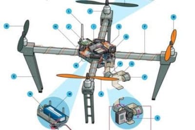
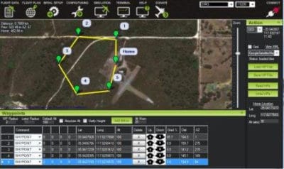
Drones that follow you came on the scene in 2016 and the follow me innovation has continued ever since. Generally, drones with follow me GPS mode, also have other intelligent flight systems (Orbit, ActiveTrack, Points of Interest, Waypoints, Circle, Terrain Follow etc) giving you even more flying and filming options.

Read more

Quick Drone Parts Overview Along With Handy DIY Tips

Drone Parts And Components Guide

All drone parts and components are vital to a smooth and safe flight. Knowing the parts of a drone will give you extra confidence while flying. You will also know which components to inspect on a regular basis and the drone parts which are easy to replace or upgrade.

If you have any flight problems, then knowing what each drone component does will assist you greatly in getting to the bottom of any flying issues.

This article will provide you with a great overview of all the drone parts and components which you will find on a modern day consumer and professional drone.

Read more

How To Secure Your Drone From Hackers Permanently

Tip and Information To Secure Drone From Hackers

Imagine your drone being hacked into and stolen while in mid flight. Your drone just starts to fly away from you. After you run to see where it has gone, your cannot find it. It has just disappeared.

Or just as bad, you lose control of your drone and it crashes.  You blame your piloting skills or electric interference from a telephone mast. But the problem is, your drone has been hacked into.

Drones are very much like flying computers.  They have operating systems, network connections and hardware which all have programmed code.  So in many ways a drone is just as easy to hack into as a computer.

Someone that can hack into a computer can hack into a drone.  They just have to make the connection to either your remote controller (cellphone, tablet, laptop) or to the drone by intercepting the signal.  But there are ways you can secure your drone from hackers.

Read more

Best 4K Camera Drones To Create Stunning Aerial Film

Top 4k Drones For Aerial Filming

Today, we review the 12 best 4k drones on the market. We also take a quick look at 4k camera technology and the real benefits to filming with a 4k drone camera.

Without doubt, the aerial footage from a 4k drone is without doubt just stunning. These 4k drones high lighted in this post are all equipped with ultra high definition video cameras and are all capturing spectacular videos.

These 4k drones have advanced features such as precision stabilization along with autonomous flight modes such as follow me, orbit, waypoints and active tracking to make filming easier. There are also a number of 4k drones with obstacle detection and collision avoidance.

4k video recording cameras on drones is becoming the standard entry point for professional aerial filming. In 2016, we started to see the first of the 4k drone cameras coming to the market. 2017 and 2018 produced a number of 4k video recording drones.  Now, in 2019, we have many drones with 4k cameras including the latest DJI Mavic 2 Pro and Zoom drones.

Read more

10 Best FPV Drone Goggles For A Terrific Flying Experience

Best FPV Drone Goggles

Flying using FPV drone goggles is a terrific experience. To have the best flying experience, it is important to choose the best FPV glasses, which are correct for you.

Knowing about field of view, IPD, glass optics, resolution and digital head tracking will help you pick the right drone goggles.

A number of drone manufacturers now have their own drone goggles.  DJI, Parrot, Walkera And Yuneec now manufacture their own FPV drone goggles.  This makes choosing an FPV headset very easy.

Now if you own a DJI or Yuneec drone etc, you don’t have to buy their goggles as many drone goggles from the various manufacturers will work on the latest top drones on the market.

It is important to fly using the correct drone goggles for your eyes. If you choose an incorrect fitting FPV headset, then you won’t enjoy the experience as much as you should.  Most drone goggles on the market now have many adjustable settings and are very comfortable.

In this article with videos, we show how to choose the best FPV glasses along with looking at some of the most popular FPV headsets on the market.  FPV goggles from Fat Shark, Skyzone, Epson, Oculus, Zeiss, Yuneec and Walkera along with both of the latest DJI FPV goggles.

Nearly all the FPV goggles featured in this article can be used for flying drones, watching movies and playing games.

Read more

Multispectral Imaging Camera Drones In Farming Yield Big Benefits

Multispectral imaging agriculture drones with sensors

Multispectral imaging camera sensors on agricultural drones allow the farmer to manage crops, soil, fertilizing and irrigation more effectively.

There are huge benefits both to the farmer and to the wider environment by minimizing the use of sprays, fertilizers, wastage of water and at the same time increasing the yield from crops.

Multispectral camera remote sensing imaging technology use Green, Red, Red-Edge and Near Infrared wavebands to capture both visible and invisible images of crops and vegetation.

The multispectral images integrate with specialized agriculture software which output the information into meaningful data.

This land telemetry, soil and crop data allow the  grower to monitor, plan and manage the farm more effectively saving time and money along with reducing the use of pesticides. 

Read more

Introduction To UAV Photogrammetry And Lidar Mapping Basics

Using UAVs for photogrammetry and aerial LiDar mapping

UAV lidar and photogrammetry imaging applications are increasing rapidly. This is not surprising as using GPS enabled UAVs for aerial surveying is very cost effective in comparison to hiring an aircraft with photogrammetry equipment.  

Because UAVs are relatively inexpensive, organisations will have their own UAV fleet, allowing for rapid surveys over large land areas and infrastructure projects where required. 

With GPS equipped drones, digital cameras and powerful computers, surveys have an accuracy right down to 1 centimeter.

This post takes an overall look at this drone mapping technology. We also take a quick view at the sectors benefiting from using UAVs for photogrammetry and lidar mapping.  We also look at some of the best mapping drones on the market along with the compatible software.

Another closely related sector is using LiDAR sensors mounted onto drones.  It’s another growing sector and you can read further regarding drone LiDAR use here. 

Read more

How To Update 3DR Solo Firmware To Fix Issues And Add Features

How To Update 3DR Solo Firmware

Knowing how to update your 3DR Solo firmware to the latest version is very important.  The Solo firmware upgrades will fix bugs in the software along with adding new flight features giving you a far better flying and filming experience.

Upgrading the firmware software on the Solo remote controller and quadcopter is pretty easy.

The whole process takes approximately 15 mins overall.  We will take you through the steps here with an excellent video at the end.

3DR really pack their firmware upgrades with plenty of new features for the Solo quadcopter, the GoPro camera and the remote controller.  They have added new flight control systems,  introduced extra features to the Solo App and expanded their SDK software.

Read more

UAVs In The Lidar Applications Sector Increases Substantially

Lidar Applications And Systems Using UAVs

The market for lidar UAVs and their applications is growing fast and and will continue to increase over the next decade.  In 2015, the figure spent on drones using Lidar was around the USD 300 million.

However the lidar market is expected to rise to more than $1 billion by 2020. This is an increase of 20% year on year to 2020.

Many still view airborne lidar applications through the use of fixed wing pilot aircraft.  The high cost or renting lidar equipped aircraft, pilots, lidar trained engineers has kept the use of this extremely useful technology pretty much to the minimum.  Only big money and big budgets could afford to use airborne lidar systems regularly.

Read more

Top 3DR X8 Quadcopter For Mapping And Aerial Filming

3DR Robotics X8-M Quadcopter For 3D Mapping

The 3DR X8 quadcopter range is without doubt top notch. In this X8 quadcopter review, we look at this powerful, reliable and easy to fly drone along with its options and uses.  We review both the X8+ for aerial photography, the X8-M for mapping and the Mission Planner software.

What the X8 quadcopter gives you in abundance, is options in its use. It is an autonomous drone which can take off, fly the path you have programmed in and land again.  3DR who are at the forefront in drone innovation have created a very robust platform for both aerial filming with the X8+ or creating sophisticated 3D maps and models with the X8-M quadcopter.

Read more

3DR Chris Anderson Interview From Start-up To Top Drone Company

Leading drone company 3DR CEO Chris Anderson speaks with Emily Chang of Bloomberg taking us from his kitchen table in 2007 to the major drone company they are now. Chris gives us some ideas on the future of drones in this interview.

Listening to the interview, it’s hard to believe that in 2007, the drone industry was so small. Only 8 years ago. Such a short time ago. In 2014 the drone industry seemed to be innovating at lightning speed.

Note: This article is quite old now and 3DR no longer manufacture drones and work mainly in the Photogrammetry and Mapping software.  Please feel free to continue reading this article or view the latest drone news here. These articles are right up to date covering from the latest innovations, technology and company news.

Read more